Keith and Vivien
THOMAS
Directions
CONTACT US
keith@keith-vivien.org.uk
vivien@keith-viven.org.uk
Sher Lea
Dean Steep
Lynton
Devon
EX35 6JT
UK
01598 752084
Keith 07597980920
Vivien 07928432856
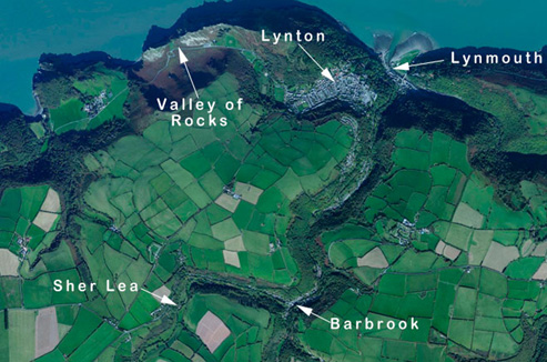
Directions to us at Lynton
You can download a copy of the directions HERE (.pdf file)
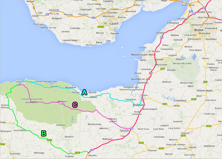
Assuming most visitors will be coming from more northerly or easterly places our main connection with the rest of the world is via the M5 heading south from Bristol. If you are coming from the east then the obvious route will be via the M4 to Bristol if from the north then you will probably already be on the M5 heading south from Birmingham.
At Bristol head south on the M5 The major junction here is Junction 15 on the M5 but also Junction 20 if you are coming from the M4. Watch out you don't head off into Bristol at Junction 16 which comes up almost immediately you must NOT be in the nearside lane, move to a centre lane (there are 4 here) to continue on the M5. Once clear of Bristol you will go over the River Avon on a high bridge at Avonmouth and the traffic will start to thin out. You will start to climb and the two directions will separate because of the gradient. Continuing south past Weston-super-Mare (Junction 21) and past the Mendip Hills.
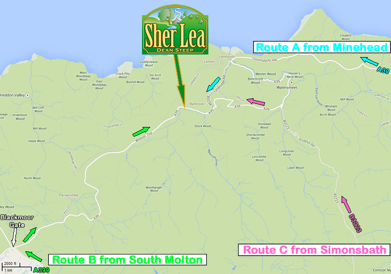
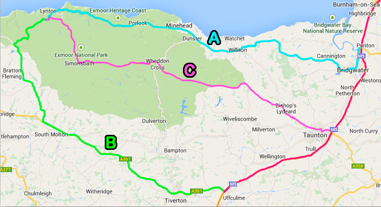
From the M5 (shown RED on the map below) there are three possible routes each having there own idiosyncrasies.
This is a short description of each route. See the map below. The distances and times are those calculated using Google Maps FROM THE M4 / M5 JUNCTION AT BRISTOL
ROUTE A (CYAN) 82 MILES 2 HOURS 2 MINUTES (from Bristol) - via Minehead is the shortest. It is not straight by any means and can get quite congested especially in the summer holidays. There is also quite a few 30mph areas no dual carriageway and on the rest of it you will be lucky if you can do much above 50mph Porlock Hill is a problem. It is VERY steep and long and the first bit has some nasty bends. I would not recommend this way if you are towing a caravan unless you have plenty of power. It is fine for any normal car though and the decent down into Lynmouth (Countisbury Hill) (just as steep and long) is magnificent.
ROUTE B (GREEN) 106 MILES 2 HOURS 1 MINUTE (from Bristol) - is the longest distance but no necessarily any longer in time and it is the easiest drive. You stay on the M5 longer and then the A361, 'link road' as it is known, has quite a bit of dual carriageway. The rest of the route is all A roads. Also no hills of any consequence on this route so good for caravans and removal vans!
ROUTE C (PINK) 92 MILES 2 HOURS 9 MINUTES (from Bristol) - was our favourite route before we moved down. After the M5 it is a bit congested getting around Taunton on the so-called ring road but after that it is all nice countryside. After Taunton it is mostly B roads however don't let this put you off because most of it is quite straight and wide. It is mostly in the Exmoor National Park and the last few miles climb up over the moor and then down into Barbrook which is where we are.
EACH OF THE ROUTES IS SHOWN BELOW
If you want to find us on Google Earth we are at 3º 51´ 20˝ West 51º 12´ 48˝ North
MORE DETAILS OF THE ROUTES
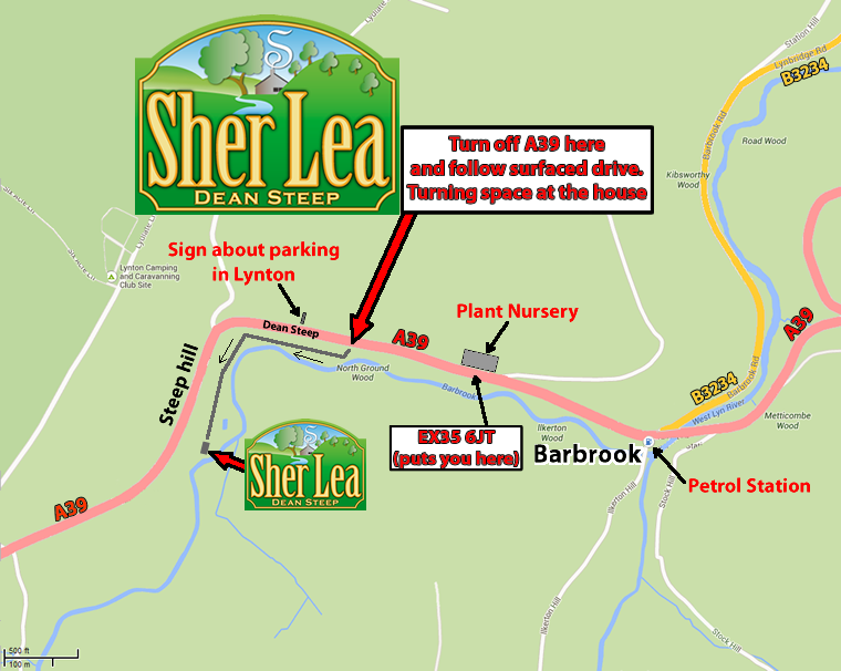
WHEN YOU GET CLOSE -